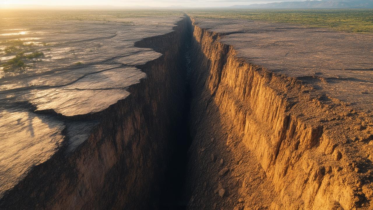
If you stand on the floor of the Great Rift Valley at dawn, the world feels like it’s holding its breath. The air is cool and faintly metallic, steep escarpments rise like broken teeth on either side, and far below, a line of mist hovers over a string of long, narrow lakes. It looks timeless, like a landscape carved ages ago and then left alone. But beneath your boots, the ground is not still at all. It is stretching, cracking, and drifting apart, millimeter by millimeter. Africa is splitting in two, and even though the continent will look roughly the same for thousands of years to come, that slow-motion tear is already measurable today.
The Continent That Hums and Stretches
The idea that a whole continent can split sounds like something out of science fiction. We imagine sudden cataclysms—mountains shattering, oceans rushing in overnight. The reality is quieter but far more astonishing: Africa is slowly pulling itself apart along a vast scar known as the East African Rift System, and sensitive instruments can already feel every tiny shiver of that process.
Scientists monitor this invisible motion with GPS stations anchored in concrete, bolted deep into bedrock. These devices don’t care how imperceptible the change is to the human eye. They track locations down to a few millimeters, quietly logging how far apart they drift from each other year after year. When researchers compare the data, a faint but unmistakable story emerges: eastern Africa is edging away from the rest of the continent at a pace of a few millimeters to about a centimeter per year.
That distance is roughly the speed your fingernails grow. In a week, it’s nothing. In a lifetime, it’s still not enough to see with the naked eye. But stretch that pace across millions of years, and you begin to see how oceans are born, mountains sag and collapse, and coastlines are redrawn. The seemingly solid stage on which we live is, in fact, part of a very slow, very patient dance.
How Do You Measure a Moving Continent?
The ground beneath East Africa moves for the same reason all continents shift: the restless churning of Earth’s mantle. Deep below the surface, heat from the planet’s interior sets solid rock creeping and convecting like an extremely slow-boiling stew. That movement tugs and twists the rigid plates that carry continents and oceans on their backs.
In eastern Africa, something special is happening. Many geologists think a plume of unusually hot mantle is pushing upward beneath the region, thinning and weakening the crust above. As that happens, the surface fractures into long faults, and immense blocks of crust begin to slump and pull apart. The East African Rift System is the visible footprint of this: a chain of valleys, volcanoes, and lakes that stretches thousands of kilometers from the Red Sea down toward Mozambique.
To measure this motion, scientists install GPS stations on opposite sides of these faults. Each station talks to a constellation of satellites, constantly calculating its exact position on Earth. A single measurement isn’t very helpful—too much random noise. But when you collect these data day after day, year after year, the noise averages out and a clear signal appears: the stations are creeping away from each other.
| Region | Approximate Separation Rate | What It Means Over Time |
|---|---|---|
| Northern East African Rift (Afar, Red Sea) | Up to ~10 mm per year | About 10 km in 1 million years |
| Central Rift (Kenya, Tanzania) | Few mm per year | Several kilometers in a million years |
| Southern Rift (Malawi, Mozambique) | 1–5 mm per year | Gradual widening of valleys and lakes |
| Average Continental Plate Motion | 20–50 mm per year | Oceans open and close over tens of millions of years |
On a phone screen, those numbers may seem almost trivial. But they’re telling us something profound: the African continent is already behaving as if it’s being pried into two parts—the Nubian plate to the west and the Somali plate to the east. The split is not a future event. It is a process already underway, unfolding in slow motion beneath the feet of millions of people.
The Landscape Where Continents Are Born
The East African Rift is not just a line on a map; it’s a place of startling, almost cinematic scenery. Think of Ethiopia’s Afar Depression, where the air shimmers with heat over bare salt flats that lie below sea level. Here, the crust is so thinned and fractured that volcanic fissures can rip open the surface in a matter of days, as happened during the 2005 Dabbahu rifting event. GPS instruments recorded the ground splitting by several meters almost overnight, a quick burst in a much longer story.
Further south, the rift valleys unwind like a chain of scars across Kenya and Tanzania. Steep cliffs drop to wide, dusty flats where acacia trees stand like scattered umbrellas and herds of zebra move in slow, patterned lines. At the valley’s base lie long, finger-like lakes such as Turkana, Manyara, and Tanganyika, some of the deepest and oldest lakes in the world. They sit in basins that are literally being pulled apart, their waters filling the low spots in an evolving fracture.
At night, red eyes appear on the skyline where volcanoes like Ol Doinyo Lengai simmer quietly above the plains. In some places, you can hike through steaming fumaroles and bubbling hot springs, the ground warm and hollow-sounding underfoot. Everything about these landscapes whispers that the crust here is thinned, stretched, and restless.
Despite the drama, the long-term pace remains glacial. The big rift valleys are the visible outlines of a process that spends most of its time invisible: the internal rearrangement of a continent. To stand there is to occupy a front-row seat at the birth of a future ocean, even though that ocean will not arrive for many, many human lifetimes.
Thousands of Years vs. Millions of Years
When people hear that “Africa is splitting,” a common question is whether someone living there today will ever see a new sea pouring into the rift. The answer is almost certainly no—and that is part of what makes this story so strange to human intuition.
We are wired to notice fast change: storms rolling in, floods, earthquakes, eruptions. Plate tectonics works on a different clock entirely. The rates measured today—millimeters per year—are snapshots in a much longer movie. For the rift to fully evolve into an ocean basin, the crust must thin further, fault blocks must sink and rotate, and eventually, ocean water must find a path in. That transformation typically plays out over tens of millions of years.
Over the coming thousands of years, though, the changes will still be real. Valleys may deepen. Some lakes could lengthen and merge. Faults will continue to shift in earthquakes, sometimes suddenly reshaping the surface: dropping a patch of farmland by a meter, offsetting a road, or changing the flow of a river. Volcanic eruptions will build new cones while older ones erode. The scenery will evolve, just very, very slowly.
The GPS data we collect today are like the first pages of a book whose ending we will never personally see. And yet, they are essential: they tell us which way the story is going and how fast the plot is unfolding.
The Human Story on a Moving Continent
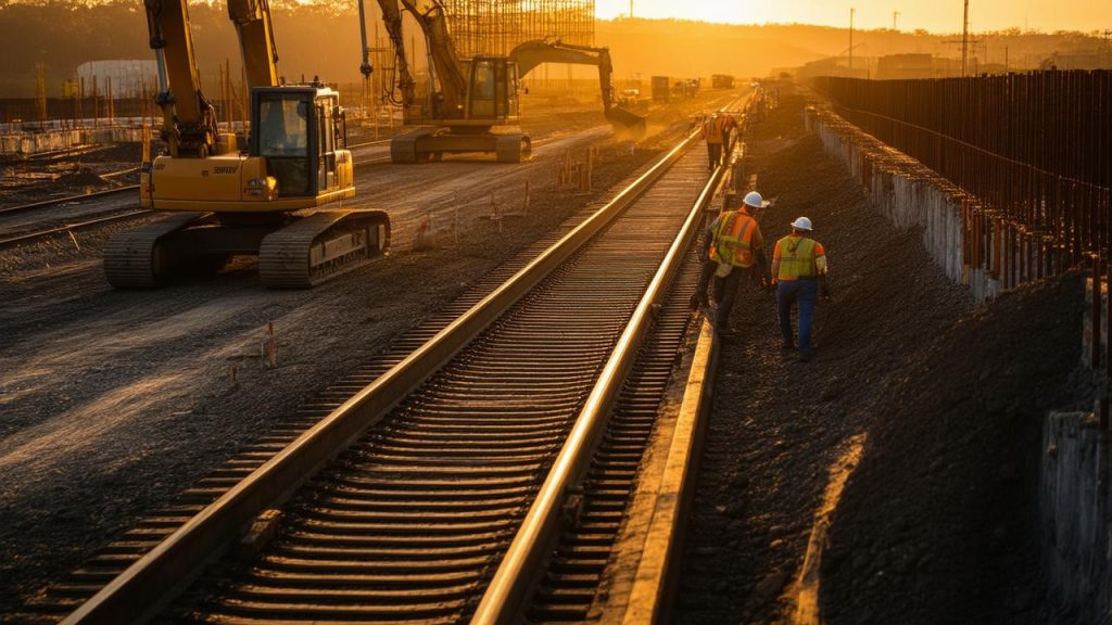
For people living along the rift, this vast tectonic experiment is not an abstract concept. It is part of daily life. Farmers till volcanic soils that are dark and crumbly, rich in minerals drawn from deep underground. Pastoralists move their herds across open rift floors, following grass that springs up on fresh, ash-laden ground after an eruption. Cities rise at the foothills of active volcanoes and along fault-bounded lakes that provide crucial freshwater and fisheries.
The same forces that split continents also shape hazards. Earthquakes rattle towns built on soft sediments. Lava can erupt along fissures close to where people live, as has happened around Nyiragongo and other volcanoes. When rift lakes lie in deep, steep-sided basins, they can even trap gases like carbon dioxide at depth, creating rare but deadly risks if those gases suddenly escape.
Yet the rift is also a cradle of opportunity. Geothermal energy projects tap into the heat of the fractured crust to generate electricity from steam. Unique ecosystems flourish in the strange chemistry of rift lakes—alkaline waters where flocks of flamingos sift for microscopic food, and deep, oxygen-poor basins where fish have evolved in isolation for millions of years. The scenery draws travelers from around the world, fueling tourism economies in Kenya, Tanzania, Ethiopia, Rwanda, and beyond.
There is an older, deeper human story here as well. Many paleoanthropologists believe that key chapters of our species’ evolution unfolded within or near these rift valleys. The rift’s shifting lakes and climates may have nudged early hominins to adapt—walking upright across broken ground, innovating with tools as landscapes opened and closed around them. In a way, our own history is tangled with this slow tectonic unzipping of a continent.
The Future Map of Africa
Imagine flying over Africa 50 million years from now—if you could. The outline on the map might look radically different. Where the East African Rift now runs, there could be a narrow ocean, the kind you see where the Red Sea splits Arabia from Africa. Islands might stretch along the seam like volcanic stepping stones, marking where magma wells up along the new mid-ocean ridge.
➡️ “I feel like I’m always bracing for something”: psychology explains anticipation mode
➡️ By dumping sand into the ocean for more than a decade, China has managed to create entirely new islands from scratch
➡️ “No one explained how to do it”: their firewood stored for months was actually unusable
➡️ “This slow cooker meal is what I start in the morning when I know the day will be long”
➡️ A quick and natural way to make any room smell fresh, without using sprays or scented candles
➡️ A Nobel Prize winning physicist says Elon Musk and Bill Gates are right about the future, with far more free time but fewer traditional jobs
➡️ 8 phrases deeply selfish people often say without realising it
To the west, a slightly smaller “Africa” could sit where the Nubian plate is today. To the east, a long, lean continent composed of what is now Somalia, eastern Kenya and Tanzania, parts of Ethiopia, and the Horn of Africa might drift away, separated by that newborn ocean basin. The Great Rift’s lakes would be gone, replaced by saltwater bays and shelves alive with corals and fish.
All of that is speculation based on how other rifts have evolved in Earth’s past—the Atlantic, the Red Sea, the Gulf of Aden. No one can say exactly how Africa’s story will end. Tectonic plates collide, rearrange, and sometimes fail to fully split. New mantle plumes can appear, changing the pattern all over again. But the measurements we have today are our best clues: they show that Africa is already behaving as if a future ocean is in its earliest, most hesitant stages of formation.
It is a lesson in scale. On the timescale of news cycles and human lives, Africa is steady. On the timescale of continents, Africa is in motion, right now, as you read this—a giant landmass quietly testing the seams of its own existence.
Measuring the Unseeable
Perhaps the most humbling part of this story is that our instruments can now detect changes that our senses never could. A metal tower in a dusty field, humming softly with electronics, notices that it has moved half a centimeter since last year. A cluster of seismometers hears tiny pops and snaps beneath a volcanic plain—micro-earthquakes that record the slow opening of new fractures. Satellite radar images capture the ground sagging by millimeters after magma drains from a chamber deep below.
These data don’t look dramatic at first: squiggly lines, clouds of dots, maps shaded in cautious colors. But when scientists interpret them, they can tell us: Here, the crust is stretching. Here, the split is widening. Here, the future edge of a continent is quietly taking shape.
We will never watch Africa break in real time. The grand changes will slip by us, too slow to notice day to day. Yet by stitching together countless small measurements, we can glimpse a kind of future memory—a preview of what this restless planet is sculpting beneath our feet.
If you return to that Rift Valley dawn and listen again, the silence feels different. You know now that the ground is moving, that one day in the far future waves may roll where you stand. You still can’t see the motion, but the numbers assure us it is there, steady as a heartbeat. Africa’s tectonic split is not just a distant prediction. It is a story already unfolding, one quiet millimeter at a time.
Frequently Asked Questions
Is Africa really splitting into two separate continents?
Yes, geologically speaking. GPS measurements and earthquake data show that the Nubian plate (most of Africa) and the Somali plate (eastern Africa) are moving slowly away from each other along the East African Rift System. Over tens of millions of years, this could eventually form a new ocean between them.
Can people living in East Africa see the continent splitting?
Not directly. The motion is on the order of millimeters per year—far too slow to see with the naked eye. What people do experience are the side effects: earthquakes, active volcanoes, changing lake levels, and evolving landscapes shaped by ongoing rifting.
Will a new ocean appear in our lifetime?
No. The full transformation from rift valley to ocean basin typically takes tens of millions of years. While the early stages of this process are already measurable, the arrival of true ocean waters filling a wide basin lies far beyond any human timeframe.
Is the splitting of Africa dangerous for people living there now?
The slow plate motion itself is not dangerous, but the tectonic setting does bring hazards. These include earthquakes, volcanic eruptions, ground cracking, and occasional gas-related risks around some deep rift lakes. Understanding rifting helps scientists better assess and prepare for these hazards.
How do scientists measure such tiny movements of the Earth’s crust?
Scientists use high-precision GPS stations anchored into bedrock, satellite radar (InSAR), and networks of seismometers. By combining these tools and analyzing data over many years, they can detect movements of just a few millimeters and map how the crust is stretching and breaking.