The first thing you notice is the sound. Not the gentle fizz of waves on sand, but a deep, ragged roar—like a freight train made of water. It’s 3 a.m. on Australia’s east coast, and a winter storm is throwing itself at the shoreline. Streetlights flicker as spray leaps over the dunes. Somewhere behind the roar, you hear a different noise: concrete cracking, rocks shifting, a seawall taking the hit for the town behind it.
When the Ocean Remembers the Past
On calm days, it’s easy to forget how much pent-up energy the ocean carries. Families walk along foreshore paths, kids drag scooters over the tiled promenade, and tourists sit on sea walls with fish and chips. The sea feels polite, almost domesticated. Yet coastal planners in Australia have started to talk about these quiet days differently. They call them “windows between events,” as if storms are the norm now, and tranquillity is the brief interruption.
For many of them, there is a particular storm that lives in their memory—the one that changed how they look at a simple line of concrete or rock. In Sydney, it might be the June 2016 East Coast Low that scattered swimming pools and backyards down onto the sand at Collaroy. For others, it’s the 2022 floods, when systems lingered and stacked up with high tides, pushing water further inland than locals had seen in decades.
Walk with a coastal engineer along a suburban beach after one of these storms, and they see a different landscape entirely. To most of us, the seawall is a reassuring border, a solid edge that says, “Here is land. There is sea.” To them, it is a temporary negotiation, an experiment being tested in real time by a restless, warming ocean.
And the ocean, lately, has been marking its corrections in bold red ink.
Old Walls, New Storms
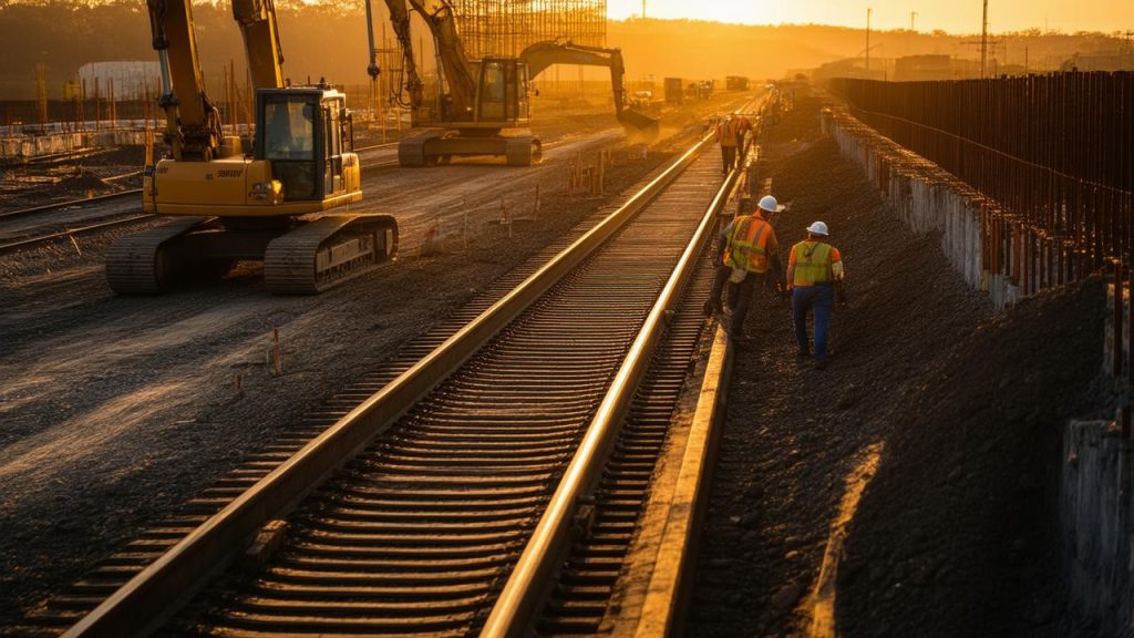
For decades, Australia’s coasts were managed with a simple, almost intuitive rule: if the sea is eroding the shore, build a barrier. Sea walls went up in concrete and rock armouring, built to protect homes, roads, and businesses perched perilously close to the water. Many were designed with the climate of the past in mind—when sea levels were lower, storms a little gentler, and future projections more cautious.
Today, those old design assumptions are colliding head-on with shifting reality. Warmer waters are feeding more intense storm systems, and higher background sea levels are giving storm surges a head start. A surge that once just touched the top of a wall now overtops it with room to spare, sending green-brown sheets of water across car parks and into streets, filling gutters and ground floors with a churning soup of sand, debris, and seawater.
In coastal planning offices from Fremantle to the Gold Coast, the language is changing. Engineers talk less about “holding the line at all costs” and more about “dynamic adaptation,” “living shorelines,” and “managed retreat.” They speak of sea walls not as permanent solutions, but as components of a larger, evolving strategy—one that has to reckon with a coastline that is moving whether we like it or not.
From Hard Edges to Flexible Thinking
The old approach treated the coastline as a fixed boundary, something that could be pinned in place. Build the wall, armour the base, raise the road behind it, and the rest would follow. But storm surges have been peeling back that illusion. In many places, the wall holds—for now—but the sand in front of it disappears, scoured away by churning water that rebounds off the concrete. The beach narrows, waves hit harder, and the wall itself begins to fail faster.
New strategies try to work with this movement rather than deny it. Instead of endless, uninterrupted walls, planners are experimenting with hybrid systems: sections of engineered defence paired with stretches of restored dunes, mangroves, saltmarsh, or gently sloped revetments designed to absorb rather than deflect wave energy. In some pockets, “sacrificial” beaches are allowed to erode during big storms, then rebuilt with sand nourishment afterwards.
The human stories behind these shifts are complicated. The resident who has watched the same beach for forty years sees not “shoreline realignment” but the shrinking playground where their kids once built sandcastles. The café owner on the esplanade hears “managed retreat” and imagines bedsheets over their windows and a For Lease sign flapping in the sea breeze.
So coastal planners are learning a second skill alongside their technical training: storytelling. They’re sketching possible futures not just in contour maps and flood projections, but in plain language and photos—this is your street in 2050 with a raised, stepped seawall and dune plantings; this is your street if we keep the old wall and let the sea come higher each year. The data is sobering, but the aim is not fear. It’s agency.
Reading the Coastline Like a Diary
Spend enough time with a coastal geomorphologist, and the beach starts to read like a long, looping diary entry. Those jagged notches in the dune face? Last month’s storm. The wide, flat berm? A season of calmer waves quietly pushing sand back to shore. The rippled sandbars? A memory of energy, written in grains and water.
In this diary, sea walls leave loud, permanent signatures. A straight wall on a curving coast can disrupt how sand flows alongshore, creating pockets of erosion downstream like a stone placed in a slow-moving stream. Higher and more frequent storm surges intensify these effects, snapping weak points in the system wide open.
Planners now lean heavily on modelling, running thousands of storm scenarios against different wall heights, alignments, and accompanying natural buffers. They talk about “design storms”—not single, freak events, but clusters of storms layered over decades of sea-level rise. A wall that looks safe in a 20-year view may fail spectacularly halfway through its intended 80-year life.
The shift is forcing councils to confront awkward trade-offs. Do you spend heavily now to build higher, broader defences for suburbs with only a few decades of safe occupancy left? Do you invest in nature-based buffers that may take years to mature while storms intensify in the meantime? Do you draw a line on a map and say, quietly at first, “Beyond this, it’s not defensible”?
A New Toolkit for an Uncertain Shoreline
In practice, revising sea wall strategies doesn’t mean tearing everything down. It looks more like a crowded toolkit gradually being rearranged. There are still concrete walls and rock revetments, but they are being raised, reshaped, and sometimes perforated or fronted with gentler slopes to break waves rather than bounce them.
More and more, they are being paired with soft solutions. Dune reconstruction brings in truckloads of sand, held in place with native grasses whose roots knit the surface like careful stitching. Offshore, artificial reefs or cleverly placed rock groynes coax waves to deposit sand where beaches are vanishing. In estuaries and low-lying bays, saltmarsh and mangrove restoration slows incoming water, storing storm surge like a natural sponge.
These layered defences are often framed as “multiple lines of protection.” If the first line—a dune or saltmarsh—takes the initial brunt, the wall behind it faces a calmer, reduced surge. It can be lower, less obtrusive, cheaper to maintain, and more compatible with life at the land–sea edge: fishing, walking, wandering, pausing.
Behind each option sits a stack of spreadsheets that try to capture cost, benefit, and risk. In pared-back form, those choices might look something like this:
➡️ Across Australia scientists are mapping a silent rise in urban heat islands
➡️ Why Australian sleep researchers are rethinking blue light guidance for modern households
➡️ Inside the Kimberley where ancient rock art is reshaping Australian heritage protection debates
➡️ What Australia’s bushfire science reveals about the future of smoke exposure in cities
➡️ How Australian marine biologists are tracking coral recovery after repeated bleaching events
➡️ The quiet shift in Australian coffee culture as climate pressures reshape bean supply
➡️ Researchers identify a specific type of adult stem cell with exceptional potential to regenerate human teeth and repair bone
| Strategy | Key Strength | Main Limitation |
|---|---|---|
| Higher, reinforced sea wall | Strong, immediate protection for critical assets | Can worsen beach loss and push problems alongshore |
| Hybrid wall + dune system | Shares wave energy between natural and built defences | Requires space and ongoing dune maintenance |
| “Living” shoreline (mangroves, saltmarsh, reefs) | Enhances biodiversity while reducing surge impacts | Takes time to establish; less suited to exposed surf coasts |
| Managed retreat | Avoids long-term defence costs and risk escalation | Socially and politically difficult; needs careful support |
In council meetings, these options are not just engineering diagrams. They’re maps of emotion, too—fear of loss, love of place, reluctance to change, and, increasingly, a quiet resolve to meet the future with open eyes.
Living Beside a Moving Border
On a bright spring afternoon, the same stretch of coast that shook in the storm feels disarmingly peaceful. Children race along the top of a freshly rebuilt dune, their footprints briefly dimpling the soft sand before the wind reshapes it. Volunteers crouch in rows, tucking native seedlings into the slope: spinifex, pigface, coastal banksia, plants that have learned over millennia how to lean into salt and sand and survive.
Just behind them, the new wall rises—not a vertical slab but a stepped, stone-faced structure that invites sitting as much as it offers defence. It’s higher than the old one, and beneath the stones lies a hidden mathematics of wave heights, return periods, and freeboard allowances for projected sea-level rise. To a passer-by, though, it’s simply a place to rest and watch the ocean breathe in and out.
Australia’s coastal planners stand here too, not as distant technicians but as locals who also love these places. Many of them surf, fish, or swim at the beaches they are redesigning. They know what it feels like to duck under a heavy set wave, to taste the metallic tang of stormy foam, to see a beloved stretch of sand vanish overnight and slowly, stubbornly return.
Revising sea wall strategies in this context is not about “defeating” the sea. It is about learning to live beside a border that is constantly renegotiating itself, storm by storm, decade by decade. The walls are becoming smarter, more flexible, more honestly temporary. The plans around them are widening to include entire catchments and communities, not just neat lines on a foreshore map.
The roar of the next big storm is coming, sooner or later. When it arrives, it will test more than concrete. It will test the stories we tell about what is worth protecting, where we are willing to yield, and how we choose to share the narrow, changeable space where land and water meet.
Frequently Asked Questions
Why are Australian coastal planners changing sea wall strategies now?
Storm surges are becoming more intense and frequent as sea levels rise and oceans warm. Many existing sea walls were designed for past conditions and are increasingly being overtopped or undercut. Planners are updating strategies to handle future storms, not just repeat the solutions of the past.
Do higher sea walls always solve the problem?
Higher walls can protect key assets in the short term, but they can also accelerate beach erosion and shift damage to neighbouring areas. They are one tool, but on their own they can create new problems, especially as sea levels continue to rise.
What are “hybrid” or “living” shorelines?
Hybrid shorelines combine built structures—like sea walls or rock revetments—with natural features such as dunes, mangroves, saltmarsh, and reefs. These natural elements help absorb wave energy, reduce storm surge impacts, and support wildlife, while the built elements provide backup protection.
What does “managed retreat” actually mean?
Managed retreat is the planned, gradual moving back of buildings, infrastructure, or entire communities from high-risk coastal zones. Instead of continually raising defences, authorities and residents work together to relocate over time, reducing long-term risk and cost.
How can local communities be involved in these decisions?
Communities can take part in public consultations, coastal planning workshops, and dune or wetland restoration projects. Residents’ knowledge of local beaches, flooding history, and cultural values helps planners design strategies that are technically sound and socially acceptable.