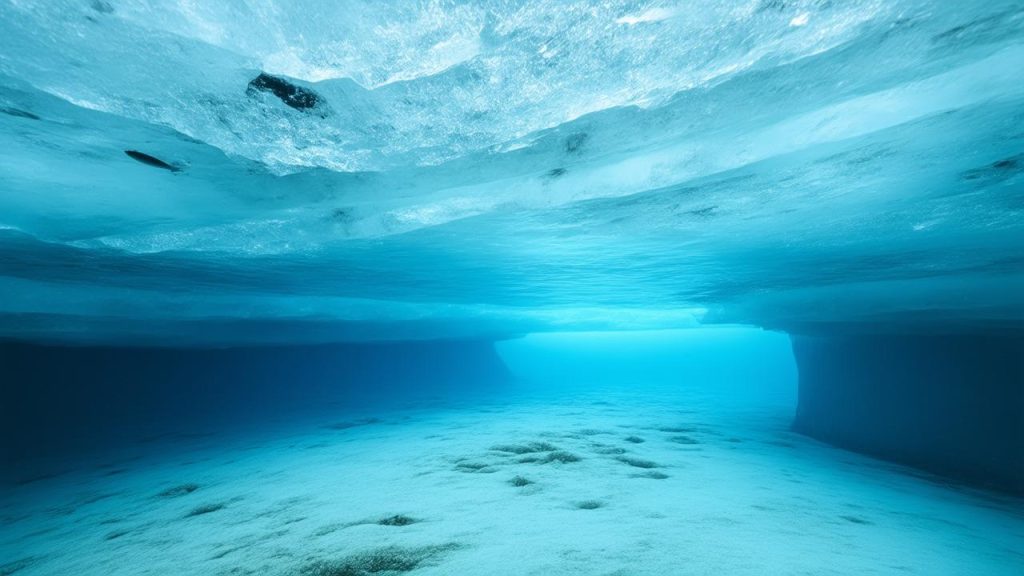
The sea was a mirror that morning, the surface so still it held the sky like glass. From the deck of a small research vessel off the coast of Greece, the horizon looked empty, almost indifferent. No hint of drama, no sign of the centuries layered beneath. But below the calm water, past the haze of sunlight and drifting plankton, an ancient ship lay in darkness, its bones slowly surrendering to the sea. It was not a new discovery. In fact, archaeologists had visited this site years ago, mapped it, cataloged it, written papers about it. And yet here they were again—returning, revisiting, almost re-reading the same wreck with new eyes, armed with a technology that could peel back the murky blue like the pages of a book.
The Return to Old Wrecks
There’s a quiet revolution happening underwater, and it doesn’t come with the fanfare of a newly discovered treasure ship or a sensational headline about “lost gold.” Instead, the story is subtler, more patient. Around the world, archaeologists are going back to shipwrecks they thought they already knew, places that were described and diagrammed in notebooks decades ago. These sites were once the cutting edge of maritime archaeology. Now, they are being reimagined.
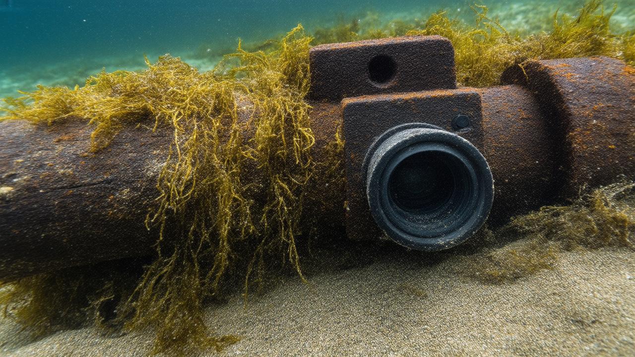
What’s changed is not the wrecks themselves—they are still the same collapsed ribs of ships, the same scattered cargoes of amphorae, cannons, timber, and ballast stones. What has changed is what we can see. New imaging technology is reshaping the underwater landscape, turning grainy, murky views into intricate, three-dimensional storyboards. These tools don’t just find wrecks; they let scientists understand them at a level no diver with a tape measure and a waterproof notebook ever could.
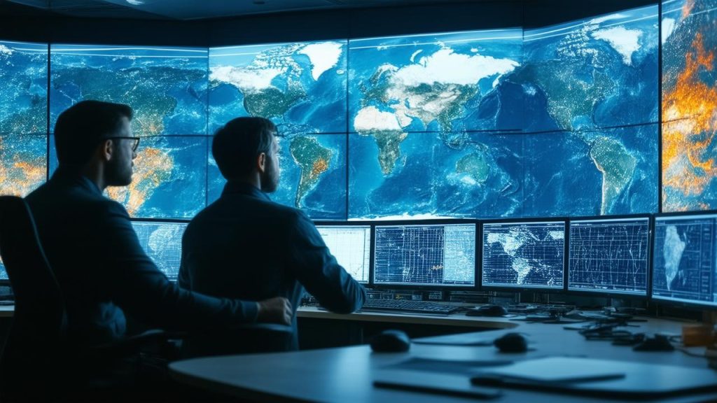
On that Greek research vessel, a team gathers around a dimly lit screen in a cramped cabin that smells of coffee, wet neoprene, and salt. The ship’s sonar has been running slow, precise lines over the wreck, painting the seafloor with sound. Moments later, a detailed 3D model bursts onto the monitor, revealing the ancient hull, the slope of the seabed, even subtle indentations in the sand where timbers have decayed. Silent, the team leans in. It’s like meeting an old friend under different light—and suddenly realizing how much you’d missed before.
New Eyes in Deep Water
The technological leap feels almost magical, though it is built on the very grounded science of acoustics, optics, and robotics. Where once divers relied on flashlights and clipboards, they now use tools that can see far beyond human limits. Multibeam sonar traces sculptural reliefs of the seafloor. Side-scan sonar records ship-sized shadows. Photogrammetry—a method that stitches thousands of overlapping photographs into 3D models—captures every curve and crack in exquisite detail. Laser scanners, tethered remotely operated vehicles (ROVs), and autonomous underwater vehicles (AUVs) add new dimensions to the work.
In practice, it feels like the wrecks are waking up. A site that once appeared as a blurry mound on a sonar plot now emerges as a clearly defined ship outline, with individual planks, broken masts, intact cargo holds, and scattered artifacts mapped down to the centimeter. Researchers can rotate the digital ship on their laptops, tilt their view as though flying over it, zoom in close enough to inspect a shattered jar or a carved detail on a masthead.
The transformation is not just visual—it’s interpretive. Earlier expeditions might have taken a handful of measurements, some photographs, a few recovered artifacts, and used that limited data to make big assumptions. Now, archaeologists can test those assumptions against a dense cloud of high-resolution points. Was the ship longer than originally thought? Did it break apart in a storm or sink slowly, settling gently into the sediment? Were crew quarters larger on one side, suggesting a social hierarchy aboard? New imaging lets them ask bolder, stranger questions.
Listening to the Seafloor: Sonar, Scans, and Silent Maps
The most otherworldly part of this work is how much of it happens in darkness. Many wrecks lie deep beyond the reach of sunlight, hundreds or thousands of meters down. Divers cannot visit these depths; only machines can. These are places of near-freezing water, heavy silence, and crushing pressure. Yet, thanks to imaging tools, archaeologists can now spend more time “on” these wrecks than any human body ever will.
Multibeam sonar sends out fans of sound pulses that bounce off the seafloor and return to the sensor. The time those echoes take to come back reveals depth and shape, building a seafloor map pixel by pixel. Side-scan sonar works like a towfish dragged behind a boat, painting broad, sweeping images of the bottom and highlighting anything that breaks the pattern—a rock, a ridge, a ship that shouldn’t be there.
Once a wreck is located, photogrammetry and laser scanning take over. A remotely operated vehicle spirals slowly over the wreck, snapping thousands upon thousands of high-resolution photos. Back on shore, software knits them into a textured 3D model that feels almost uncanny in its accuracy. You can “swim” through the digital wreck, trace the curve of its hull, flip the virtual light source from dawn to dusk to see how shadows fall into its hollows and holds.
To make sense of this new digital abundance, researchers are building comparative data sets—large archives of ship shapes, cargo configurations, and structural failures. That’s where returning to old wrecks becomes essential. Those earlier, partially studied sites are now benchmarks, reference points in time for trade routes, shipbuilding traditions, and naval warfare. Revisiting them with new imaging doesn’t just update a single site; it enriches the entire archaeological record.
Old Logs, New Maps: Why Revisiting Matters
On another coast, the wind tugs at the jacket of a marine archaeologist standing by a cluttered lab table. Old photographs of a 1970s shipwreck excavation are spread beside a sleek laptop running a 3D model of the same wreck. The old images show divers in heavy gear, clouds of silt, rough sketches of hull timbers. The new model shows each timber’s exact position, its angle, its thickness. The two visions of the same ship feel decades apart, and they are.
Revisiting familiar wrecks is not a matter of scientific nostalgia; it’s about continuity and correction. Earlier teams did the best they could with what they had, but their maps were inevitably incomplete. Measurements were hand-drawn, conditions were poor, and visibility was limited. Some wrecks were only partially surveyed before funding ran dry or storms destroyed fragile structures. In some cases, entire sections of a site remained unknown.
Now, with improved imaging, archaeologists can fill in the blanks. In doing so, they sometimes overturn old conclusions. A vessel once classified as a small merchant ship, for example, might turn out to be a more complex hybrid craft with military modifications. A pile of stones once labeled ballast might reveal patterned stacking that hints at a specific port of origin. Objects that seemed randomly scattered can be digitally “rewound” in a model, their fall paths reconstructed to show how the ship sank—bow first, stern first, or rolling onto its side.
Comparing new imaging to old notes also tells another crucial story: how fast the sea is changing the wreck. Corrosion on iron, the spread of marine life, storms that shift sediments—all of these can be measured over time. Some wrecks are vanishing faster than expected. Others are surprisingly stable. That knowledge is vital for deciding which sites to prioritize, which ones need active protection, and which can be left to rest in the dark a little longer.
From Wood and Iron to Data: A New Kind of Artifact
Every expedition now collects not just artifacts but also enormous quantities of data. Files measured in gigabytes and terabytes come back from each survey—3D models, sonar mosaics, high-resolution video. In a sense, the ship itself is becoming an artifact twice: once in the form of decaying wood and rusting iron on the seafloor, and again as a precise digital twin that can outlast both metal and memory.
These virtual wrecks are transforming how people can experience maritime history. A student in a classroom far from any coast can now “dive” a centuries-old trading vessel through a browser or VR headset, learning about ancient trade routes while walking the digital deck plank by plank. Museum visitors can explore the interior of a wreck that no diver could safely enter in real life. Indigenous communities, whose ancestors once sailed similar waters, can view and discuss wrecks that represent more than just research—they are lost stories, lost songs, lost journeys.
At the same time, archaeologists are learning to treat their data sets with the same care they give to fragile timber. Storage, accessibility, and long-term preservation of digital models present new challenges. A waterlogged wooden beam might crumble in air; a 3D model might disappear with a crashed hard drive or obsolete file format. So labs are building digital archives, standardizing formats, and training the next generation of researchers to become as fluent in data management as in underwater excavation.
Technology at a Glance
For all the poetry of underwater exploration, the heart of this new era lies in the tools that turn darkness into detail. Below is a simple overview of some of the key imaging methods now reshaping our view of old shipwrecks:
➡️ East coast councils are rewriting heat plans as pavement temperatures climb year after year
➡️ Ancient rock shelters in the Kimberley are forcing new debates about heritage enforcement
➡️ Seawall upgrades are accelerating as coastal communities brace for stronger storm surges
➡️ Small coral recovery zones are giving reef scientists a rare moment of cautious optimism
➡️ Coffee roasters are quietly adjusting blends as climate shocks disrupt bean supply lines
➡️ Public health campaigns are shifting tone as vaccine confidence becomes more uneven
➡️ Loneliness is being treated less as a feeling and more as a measurable health threat
| Technology | What It Does | How It Helps Archaeology |
|---|---|---|
| Multibeam Sonar | Maps seafloor depth and shape using sound pulses. | Creates detailed terrain models to locate and outline wrecks. |
| Side-Scan Sonar | Produces wide, shadow-like images of the seafloor. | Highlights objects that stand out from the seabed, such as hulls or cargo. |
| Photogrammetry | Combines thousands of photos into a 3D model. | Captures shipwrecks in high-resolution detail for study and public display. |
| ROVs & AUVs | Robotic vehicles that explore deep or dangerous sites. | Extend research to depths unreachable by divers, gathering imagery and samples. |
| Laser Scanning | Uses laser beams to measure surfaces precisely. | Provides extremely accurate measurements of hull structures and artifacts. |
The Ethics of Seeing More
Of course, seeing more also means bearing more responsibility. Detailed imaging can expose shipwrecks to new risks. Precise coordinates and high-quality visuals, if made public without safeguards, can attract looters and unregulated divers. Cultural and historical sensitivities also come into sharper focus when a wreck is not just a name in a report but a vivid, accessible scene.
Many shipwrecks are graves. Naval battles, storms, mutinies, and accidents have left entire crews entombed in the ships that carried them. As imaging improves, human remains or personal belongings may become visible in ways they never were before. Archaeologists must navigate how to document and share that information respectfully, often in close consultation with descendant communities, governments, and historians.
There is a philosophical question, too: at what point does a digital reconstruction become a reinterpretation? When an archaeologist digitally “corrects” a damaged hull or virtually restores a missing mast, they are not just showing what is—they are proposing what might have been. In this space between evidence and imagination, transparency becomes essential. Clear labeling, open methods, and honest communication about what is measured and what is inferred help protect both science and story.
Looking Ahead: The Future Written in Saltwater
Back on the research vessel, the sun has climbed higher, painting the sea in a blinding sheen. On the monitor, the ancient wreck is now fully rendered, a ghostly model rotating in slow motion. The team marks points of interest—joins between timbers, a cluster of cargo, a strange distortion near the keel that might hint at how the ship met its end.
This scene is replaying across oceans. From the cold depths of the Baltic to the turquoise bays of the Caribbean, researchers are layering new data over old maps, turning once-fragmentary records into fuller, richer narratives. The age of heroic individual discoveries is making room for something more collaborative and cumulative: a long conversation between past and present, told through pixels and pressure waves.
Future expeditions will almost certainly return yet again to the same wrecks we are mapping now. As imaging tools improve, as machine learning helps interpret sprawling data sets, and as virtual reality entwines more tightly with research, the same shipwreck might become the subject of many lifetimes of study. What we call “finished” today may be just a first draft in the long biography of a single sunken hull.
In that way, shipwrecks are less like time capsules and more like evolving texts. Each generation reads them with new instruments, new perspectives, and new questions. The sea keeps its secrets close, but not forever. With every ping of sonar and every sweep of a camera, the stories written in saltwater grow clearer, and the past, preserved in broken wood and scattered cargo, leans a little closer to the surface.
FAQ
Why are archaeologists revisiting shipwrecks that were already studied?
New imaging technology can reveal details that older methods simply couldn’t capture. By returning to known wrecks, archaeologists refine earlier maps, correct past assumptions, track how sites are deteriorating, and build richer historical interpretations using far more precise data.
What kinds of imaging technologies are used on shipwrecks?
Researchers commonly use multibeam and side-scan sonar to locate and map wrecks, photogrammetry and laser scanning to create high-resolution 3D models, and robotic vehicles like ROVs and AUVs to explore deep or hazardous sites beyond the reach of divers.
How do 3D models change our understanding of shipwrecks?
3D models let archaeologists study an entire wreck in context, rather than focusing on isolated artifacts. They can measure structural details, reconstruct how a ship sank, and compare vessel designs across regions and eras. These models are also powerful educational tools that allow the public to virtually explore sites that are otherwise inaccessible.
Are there ethical concerns with sharing detailed images of wrecks?
Yes. Detailed images and exact locations can attract looters or unregulated tourism, and many wrecks are also war graves or culturally sensitive sites. Archaeologists must balance transparency and education with site protection and respectful treatment of human remains and cultural heritage.
Will future technology make today’s imaging work obsolete?
It will likely make it incomplete rather than obsolete. Just as current tools improve on earlier surveys, future technologies will refine what we see today. The data gathered now, however, creates an essential baseline—capturing the condition of wrecks at this moment in time and preserving information that may be lost as the sea continues to reshape them.